Saturday, November 10, 2007

Trail now open daily!


The Bull Creek Water Quality Protection Lands (WQPL) Trail, aka the Matthew and Hazeltine Smith Trail, is now open daily for your hiking, running and biking pleasure. Please be aware that our special agreement between the City of Austin and the Bull Creek Foundation prohibits dogs, fishing, swimming or picnicing. We apologize in advance for these prohibitions, but all of these activities are allowed on the Bull Creek Greenbelt, a 3.5 mile trail, just a short walk away. (We maintain both trails.)

Please remember too that the trail was built and is being maintained by volunteers from the Bull Creek Foundation so please let us know if you see something that either needs to be improved or corrected.

Map to Bull Creek WQPL Trail:
View Larger Map

Thank you!

Friday, November 9, 2007

Thursday, November 8, 2007

History of the Stenis Tract (Bull Creek WQPL)

History of this tract

This 60 acre tract of land with Bull Creek running through the middle of it is known as the Stenis Tract for it's owners Tom and Rowena Stenis and her brother Llewellyn Smith. Rowena and Llewellyn's parents Matthew Irving Smith and Hazeline Ingram Smith bought the land in 1941 for investment and recreation. Matthew was a language professor at U.T. and bought the lower part of the tract from Dorthy Duval and the upper part from Harvey Simon. The property was part of the original James Coleman survey.

The Smith and Stenis families enjoyed their creek side property for over 50 years.
In 1992 the property was put under option for construction of 355 apartments.
That drew the attention of people in the area who thought that this pristine stretch of Austin's only Northern Edwards Aquifer spring fed drinking water supply creek should be preserved. 13 area neighborhoods expressed this sentiment. Council member Ronney Reynolds assisted in actions that led to the tract remaining undeveloped. It took until the voters approved the 1998 City bond election and efforts of Council Member Beverly Griffith to see that funds were allocated to purchase this property. It was purchased in January 1999 as Water Quality Protection Land (WQPL). This is the only tract in Northwest Austin purchased as WQPL.

Volunteers from the Bull Creek Foundation participated in a public process to define public uses for City WQPL in 1999-2000, as part of an overall land management plan which was approved by City Council in late 2000.

It took until November 2005 for Bull Creek Foundation to forge an Agreement with the City to build and maintain an educational hike and bike trail at no cost to the City.

The 1.5 mile loop Matthew and Hazeline Smith Memorial hike and bike trail is now ready for public use after 2 years of work on many Saturdays by a large number of citizen volunteers, including many school groups and Scouts.

Monday, November 5, 2007

Trail Opening Fri Nov 9 and Sat Nov 10!

NEW TRAIL OPENING

What: Matthew and Hazeline Smith Memorial Trail - 1.5 mile loop (details below)
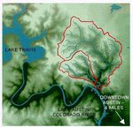
On the Bull Creek Water Quality Protection Lands tract.

Where: West corner of 360 at Spicewood Springs Rd.
Location using http://maps.yahoo.com/
5479 Old Spicewood Springs Rd 78731

Who: by BULL CREEK FOUNDATION (a 100% VOLUNTEER GROUP)

When:
Fri. Nov. 9, 10:00 a.m. (City/County officials, press, tours at 10:30)
Sat. Nov. 10, 10:00 a.m. (trail tours)
Sat. Nov. 10, 12:00 noon (recognition of Eagle Scout projects, trail tours)


Information at http://www.bullcreek.net or
bullcreekfoundation.blogspot.com
Questions? bullcreekvolunteers@gmail.com
----------------------------------------------------------------------------------
Directions to the trail head and parking

Parking is very limited. Carpool if you can or be prepared to walk a short distance.

Traveling North on Loop 360 ( from FM 2222 and other points south) - Head north on Loop 360, you'll pass through the traffic signal at Lakewood Drive. Move into the left lane and take a left at the next traffic signal at Spicewood Springs road. (Only a left turn is possible) Once on Spicewood Springs Rd, turn right onto the low water crossing road and take an immediate right into the parking lot area.

Traveling: South on Loop 360 (from 183 and other points north) - Head south on Loop 360, you'll pass through several traffic signals at Great Hills and Spicewood Springs / Bluffstone Drive. Move into the right lane and take a right at the next traffic signal at Spicewood Springs road. (Only a right turn is possible) Once on Spicewood Springs Rd, turn right onto the low water crossing road and take an immediate right into the parking lot area.


Background Information on Bull Creek Foundation

The citizen effort to preserve this tract of land in perpetuity was "the catalyst" that prompted the creation of the Bull Creek Foundation (BCF) in 1994 to watch over the 32 square mile Bull & West Bull Creek Watersheds, roughly bounded by highways 2222, 620, 183 and Mesa Drive. BCF is an all volunteer affiliate of the Austin Parks Foundation

BCF's mission is to promote the harmonious balance between nature, recreation and sustainable economic development. It is an all volunteer effort, with no staff or overhead cost, with any funds raised going directly to the projects undertaken.

Volunteer leaders head up and organize volunteer initiatives in the key action areas identified through a series of public listening sessions and a statistical survey of stakeholders by a Westwood High junior statistics class. These initiatives include preserving the greenbelt along Bull Creek, improving water quality through innovative and pioneering approaches, creating and maintaining parks and recreational trails, improving the landscape by removing invasive species and planting native species, reviewing and engaging in planned developments, preserving the "country in an city" rural corridor west of Hwy. 360 along Spicewood Springs Road, capturing area cultural/archaeological/ geological history, preserving and protecting the scenic beauty of the area, stakeholder guidance on the management of Balcones Canyonlands Preserves (BCP) for endangered species in an urban setting.

Bull Creek Foundation:
- is stakeholder inclusive, and collaborates with people in all government and educational organizations who can further its mission statement.
- has no membership roster or membership dues.
- welcomes any and all people interested in helping with its initiatives.
- has a web site www.bullcreek.net and bullcreekfoundation.blogspot.com

Wednesday, October 31, 2007

Bull Creek WQPL Trail grand opening Nov 9 & 10

What: Bull Creek Water Quality Protection Lands Trail Opening
When: November 9 2007 at 10 am (comments), 10:30 am: Tour
When: November 10, 2008: tour at 10 am, tour at 12 noon.
Who: General Public, city and county officials, press
Contact: Charlie McCabe, cmccabe@austinparks.org, 512.965.1960
Why: The first of two trails to open on City of Austin Water Quality Protection Lands, this is a 1.5 mile trail built and maintained entirely by volunteers. Come hear a quick review of its construction and take a tour of the site.

On Friday, November 9th at 10 am, the Bull Creek Foundation and the City of Austin Wildlands Conservation Division will celebrate the official opening of the Matthew Smith trail on the Bull Creek Water Quality Protection Lands tract. This 1.5-mile hike and bike interpretive trail is the first to open on City of Austin Water Quality Protection Lands (WQPL). The 60-acre Bull Creek tract, also known as the Stenis tract, was purchased with Bond funds after a successful 1998 election. Volunteers from the Bull Creek Foundation participated in a public process to define possible public uses for City WQPL in 1999-2000 as part of an overall land management plan which was approved by City Council in late 2000.

A memorandum of agreement between the Foundation and the City was signed in 2003, followed by a formal application permit process which was finalized in late 2005, allowed trail construction to begin in January 2006. Thanks to countless hours contributed by volunteers, Eagle Scout and school projects, the interpretive trail is about to open and will be maintained by volunteers from the Bull Creek Foundation.

So come hear the stories, the thanks and tour the trail. For those who cannot make it on Friday, November 9, we'll host tours of the trail on Saturday, November 10th at 10 am and 12 noon.

Directions to the trail head and parking. Parking is very limited. Carpool if you can or be prepared to walk a short distance.
Traveling North on Loop 360 ( from FM 2222 and other points south) - Head north on Loop 360, you'll pass through the traffic signal at Lakewood Drive. Move into the left lane and take a left at the next traffic signal at Spicewood Springs road. (Only a left turn is possible) Once on Spicewood Springs Rd, turn right onto the low water crossing road and take an immediate right into the parking lot area.

Traveling: South on Loop 360 (from 183 and other points north) - Head south on Loop 360, you'll pass through several traffic signals at Great Hills and Spicewood Springs / Bluffstone Drive. Move into the right lane and take a right at the next traffic signal at Spicewood Springs road. (Only a right turn is possible) Once on Spicewood Springs Rd, turn right onto the low water crossing road and take an immediate right into the parking lot area.

About the Bull Creek Foundation - We're an all volunteer affiliate of the Austin Parks Foundation, working on park and trail projects in the Bull Creek watershed. More info at: bullcreekfoundation.blogspot.com or www.bullcreek.net

Saturday, October 20, 2007

One final pre-opening workday Nov 3!

There's some last minute work to be done on the Stenis Tract (Bull Creek WQPL Tract) trail before we have the grand opening on November 9 and 10th. Please join us on Sat, Nov 3, 9 am to 12 noon to spread some granite gravel of a stretch of trail about 300 feet long and do some last minute weed wacking. RSVP/Questions to Charlie at cmccabe@mac.com if you can make it.

Here are Directions to the tract trail parking lot.

Wednesday, October 17, 2007

New Trail dedication Nov 9 and 10th!

Our new 1.5 mile hike and bike trail on the Bull Creek Water Quality Protection Lands tract (we call it the Stenis Tract) will be dedicated on Friday, November 9th at 10 am. We'll hold a brief press event and then go on a tour of the trail. We'll also have a open trail kind of like an open house) on Saturday, November 10th at time TBD.


If you can come to the Fri, Nov 9, please rsvp to cmccabe@mac.com or scameron@austin.rr.com. Thanks!

Here are Directions to the tract trail parking lot.

Sneak Peak - Photos of the Bull Creek WQPL Trail

The Bull Creek Water Quality Protection Lands Trail opens Nov 9 and we want to show you a sneak preview of portions of this 1.5 mile trail. So, here's a few shots. Click on any photo to expand the image...


Monday, October 1, 2007

Directions to the Bull Creek WQPL Tract Trail

Directions to the Bull Creek WQPL Tract - home of the Matthew Smith Trail - opening November 9th.

Directions: North on Loop 360 ( from FM 2222 and other points south) - Head north on Loop 360, you'll pass through the traffic signal at Lakewood Drive. Move into the left lane and take a left at the next traffic signal at Spicewood Springs road. (Only a left turn is possible) Once on Spicewood Springs Rd, turn right onto the low water crossing road and take an immediate right into the parking lot area.

South on Loop 360 (from 183 and other points north) - Head south on Loop 360, you'll pass through several traffic signals at Great Hills and Spicewood Springs / Bluffstone Drive. Move into the right lane and take a right at the next traffic signal at Spicewood Springs road. (Only a right turn is possible) Once on Spicewood Springs Rd, turn right onto the low water crossing road and take an immediate right into the parking lot area.

Friday, August 17, 2007

Photos from Bull Creek WQPL trail construction...

These are pictures from the parking lot construction workdays in December 2006 and January 2007.


Saturday, January 13, 2007

Welcome to Bull Creek Foundation...


We're a group of volunteers who have been working in the Bull Creek Watershed of Austin TX on park, open space and balanced development projects since 1994....

We're an all-volunteer affiliate of the Austin Parks Foundation, and we have ongoing volunteer projects at Bull Creek District Park, the Greenbelt Trail and the forthcoming Bull Creek Water Quality Protection Lands trail. Our volunteer workdays are posted on our page (that you are viewing)

Our mission is dedicated to promoting a harmonious balance between nature, recreation, and sustainable economic development within the 32 square mile Bull Creek watershed. The watershed includes high quality ecological areas with limestone seeps, springs, and waterways; scenic cliffs and waterfalls; unique archeological and cultural features; and rare plant and animal life. The watershed's boundaries can roughly be defined as the area inside highways 620 and 183, Mesa Drive, and just south of FM 2222.

For further information...
contact Skip Cameron, President
8711 Bluegrass Drive, Austin, TX 78759
home: 794-0531
email: scameron at austin dot rr dot com